Arial Views Of Graveling Point
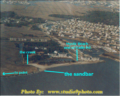 We scanned these in, so they are a little fuzzy. This first image shows Mystic beach, and the end of Radio Road. You walk down the beach to the creek, shown here at LOW tide. At low tide it is not necessary to have waders, but you may get stuck on the other side if you don't watch the tide carefully! NOTES: Don't try to cross the creek at mid to high tide. It looks shallow because it is narrow----but you will end up in over your head at high tide. Be very carefull to cross out at the very mouth of the creek where the sand bar is. Go slowly and don't drag your feet. If you go to far out into the bay, or too far in towards the creek, you will be swimming. | |
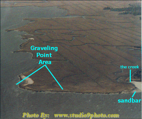 Second image picks up where the other left off, at the mouth of the creek. NOTES: Graveling Point is federal land, and part of a bird sanctuary. The surf area has been designated as a public fishing area, but in order to fish here, we have to take care of it. Please pick up all litter & supplies! Thank you! | |
| Additional Fishing Aides:
Virtual Walk to the point A Road Map to get there! | |